
A Different Tide in Buxton
While some Outer Banks communities plan for resilience, others are confronting erosion in real time—where history, infrastructure, and rising seas collide.
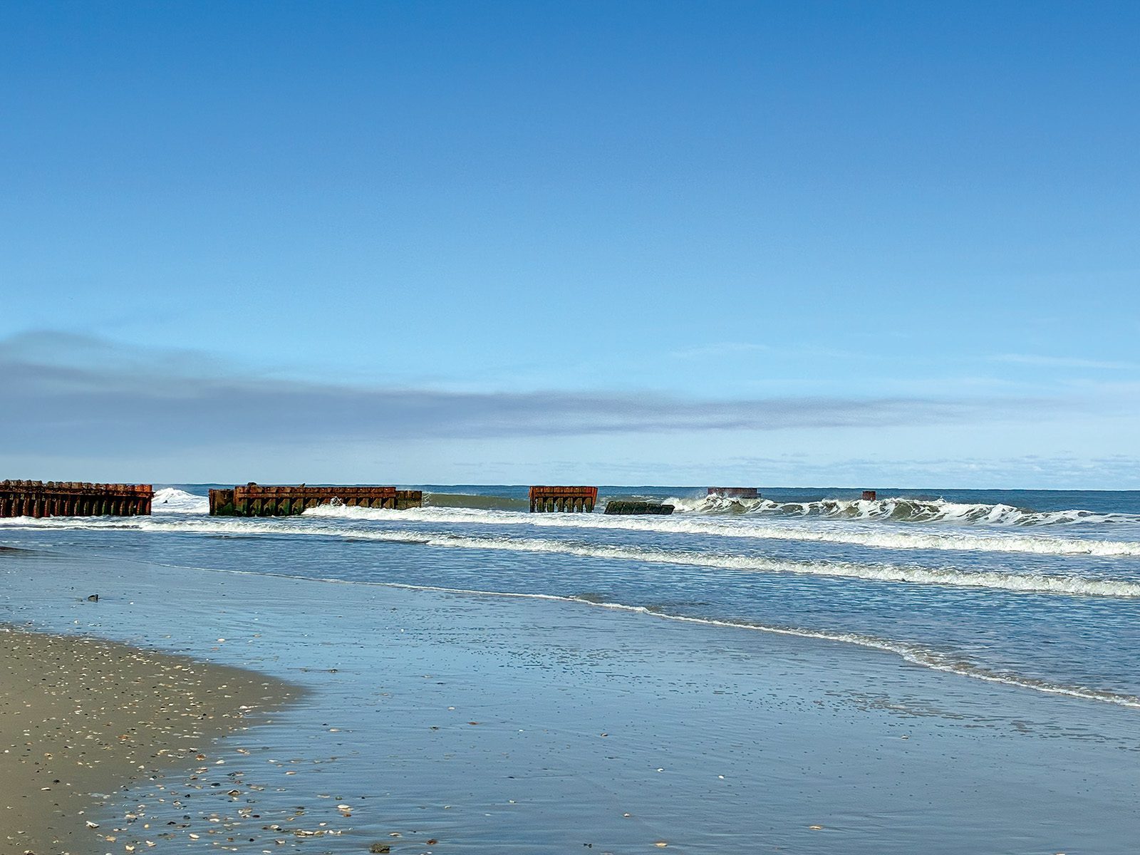
By Jes Gray / Photo above: Waves crash against the remaining panels of “Groin 3” at Old Lighthouse Beach on March 17, 2026. Photo courtesy Jes Gray.
“Two ways. Gradually, then suddenly,” Ernest Hemingway’s quip about bankruptcy in The Sun Also Rises could easily be applied to the erosion of our beaches in Buxton, N.C. On one small section south of what’s known as the Haulover Day Use Area, more than 20 homes have collapsed into the Atlantic Ocean since the fall of 2025. That brings the total number of houses lost between Buxton and Rodanthe since 2020 to at least 31 at the time of this writing.

The 1955-era Outer Banks Motel—the first buildings you see after passing Haulover—is currently shored up by dozens of emergency sandbags, the cost of which, along with other protection methods, has risen above $100,000 for owners Carol and Billy Dillon. This rapid and destructive progression cannot be explained simply by storms, barrier island drift, or sea level rise alone. To understand it fully, it helps to look to the past.
This story begins during the Cold War, when nuclear-armed Soviet submarines patrolled the East Coast of the United States. An area near “The Point” in Buxton, now part of the Cape Hatteras National Seashore, served as a top-secret Sound Surveillance System (SOSUS) listening station used to detect those submarines. The cables reportedly extended dozens of miles offshore and proved effective in 1962, when they detected and helped deter a Soviet diesel submarine.
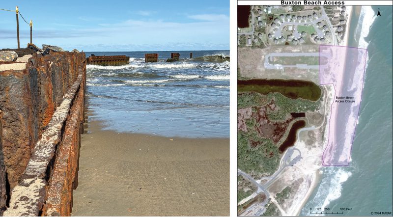
Left: Close-up southern perspective of rusted “Groin 3” panels and cordoned off area at Buxton Beach, March 17, 2026. Photo courtesy Jes Gray. Right: The updated Buxton Beach closure begins just south of the southernmost house on Old Lighthouse Road and extends to the southermost jetty. The closure includes the Buxton Beach Access parking lot.
To protect these cables and the buildings housing the Naval Facility and its service members, a groin field consisting of three parallel structures was built between 1969 and 1970, totaling 1,670 linear feet, according to Tancred Miller, director of the N.C. Division of Coastal Management. “Groin 3” was later expanded and repaired in several phases, including the addition of armor stone in 1994. The NAVFAC closed in 1982 but remained in use by the Coast Guard until 2010. The site—now classified as a Formerly Used Defense Site (FUDS)—is still undergoing remediation efforts begun by the Army Corps of Engineers in 1998 under a Navy contract to remove remaining infrastructure.
Meanwhile, the North Carolina Coastal Area Management Act (CAMA), enacted April 11, 1974, eventually placed restrictions on hard structures for coastal management, though those limitations did not take effect until the late 1970s. Despite the ban, repairs and fortifications continued under a “grandfather clause,” allowing existing structures to be maintained. Since 1994—and the well-known relocation of the Cape Hatteras Lighthouse—no significant repairs have been made. Storms and time have steadily worn down what remains, until now.
Plans have been approved to repair Groin 3, alongside another round of beach nourishment—last completed in 2022—covering a 2.9-mile stretch of Buxton from Haulover to the groin, as well as an additional 2.5 miles south of Avon Pier. A February meeting at the Fessenden Center, hosted by the Buxton Civic Association, brought together residents and local leaders to discuss the reasoning behind undertaking repairs for the first time in decades. Heather Jeannette, president of the association, noted that the deteriorating groin structures may actually be accelerating erosion at an “unnatural” rate, even when accounting for sea level rise and climate change.
Scientists who study coastal environments caution that there are no permanent solutions to erosion or barrier island migration. Dr. Laura Moore, a professor at the University of North Carolina at Chapel Hill, acknowledges that while these interventions may slow the impact, they ultimately interfere with the natural movement of the islands.
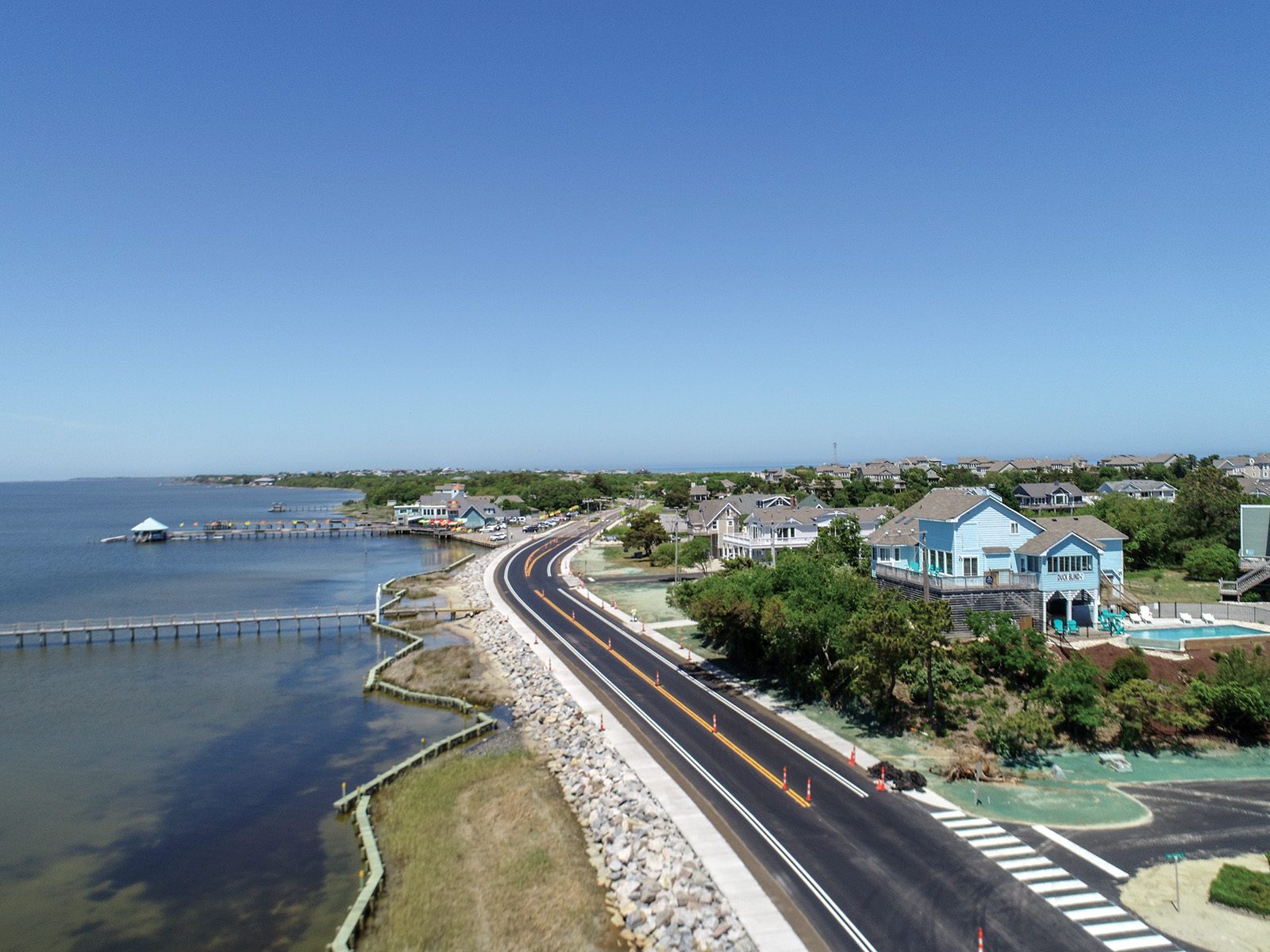
For residents, however, the concern is more immediate—getting their children safely to school and protecting their homes, investments, and livelihoods. Many support the project despite its high cost, which will be funded through a combination of federal and state sources, along with locally generated tourism tax revenue. Beach nourishment is expected to take place between June and December 2026, while the timeline for groin repair remains undetermined as bids continue to be reviewed.

Author: Jes Gray
